Persistent rain has waterlogged a lot of the countryside several times in the past and although Wednesday weather has, as usual, looked promising we frequently decided to walk on cycle tracks. There are quite a few to choose from in the New Forest and some in Wareham Forest. Rather than keep on reinventing these walks I have set out 12maps from the New Forest, below. I have mentioned a few options but there are more and you can have fun seeing how many you can find.
Route 1 Balmer Lawn 7 miles
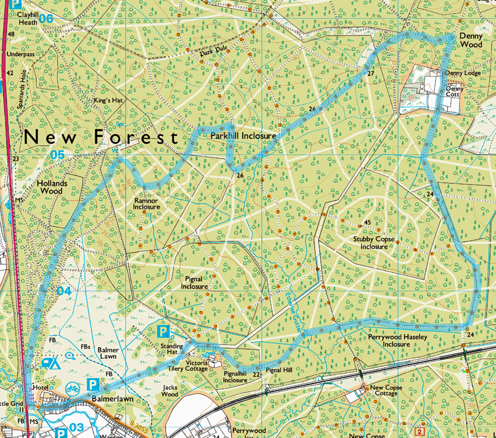
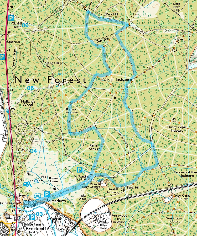
Route 2 Standing Hat 7.8 miles.
If Standing Hat car park is closed and the walk has to be started at Balmer Lawn this will add 1.5 miles. You might want to start a different walk at Stockley Cottage instead - see next two options.
If Standing Hat car park is closed and the walk has to be started at Balmer Lawn this will add 1.5 miles. You might want to start a different walk at Stockley Cottage instead - see next two options.
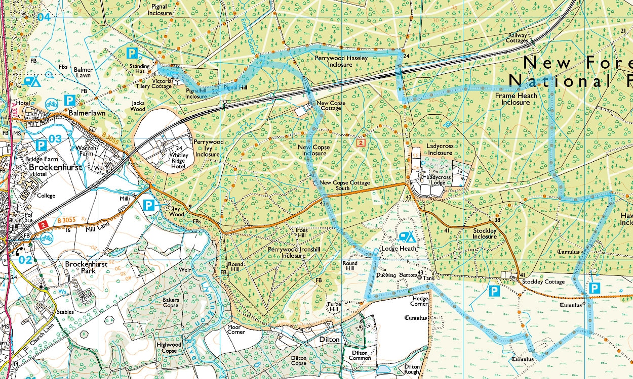
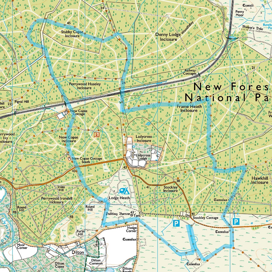
Route 3 Stockley Cottage 6.5 miles.
Stockley Cottage car park is on the road between Brockenhurst and Beaulieu.
Stockley Cottage car park is on the road between Brockenhurst and Beaulieu.
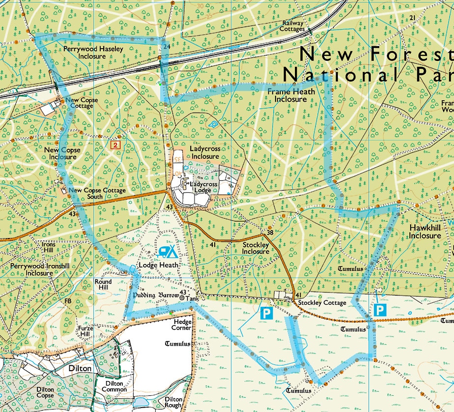
Route 4 Stockley Cottage 7.7 miles.
Stockley Cottage car park is on the road between Brockenhurst and Beaulieu.
Stockley Cottage car park is on the road between Brockenhurst and Beaulieu.
Route 5 Balmer Lawn 6.8 miles
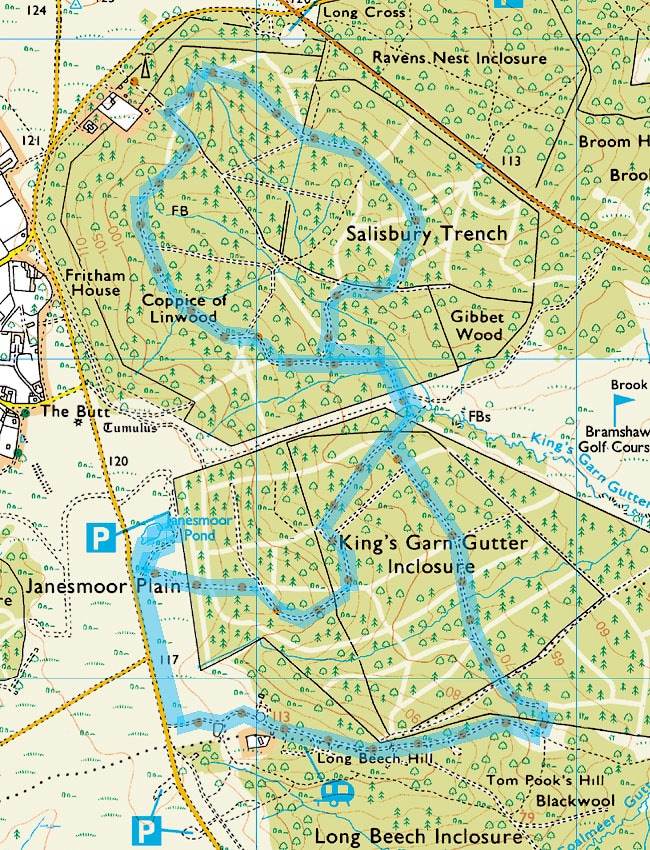
Route 6 Janesmoor Pond 5.3 miles
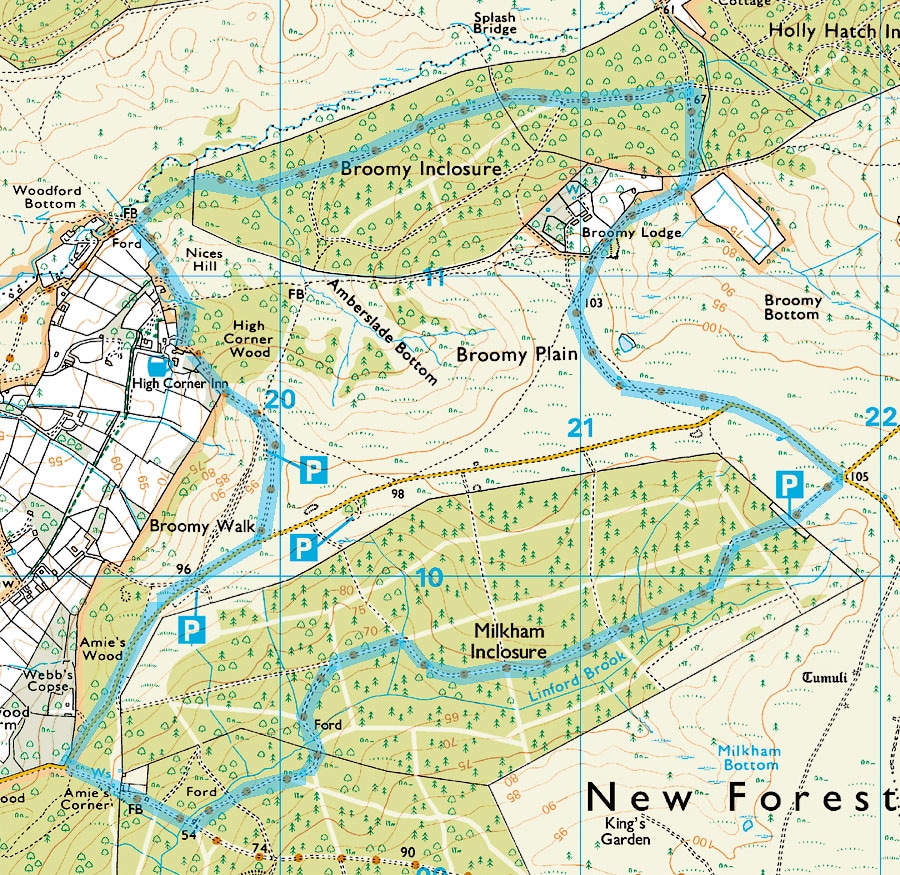
Route 7 High Corner 6.0 miles
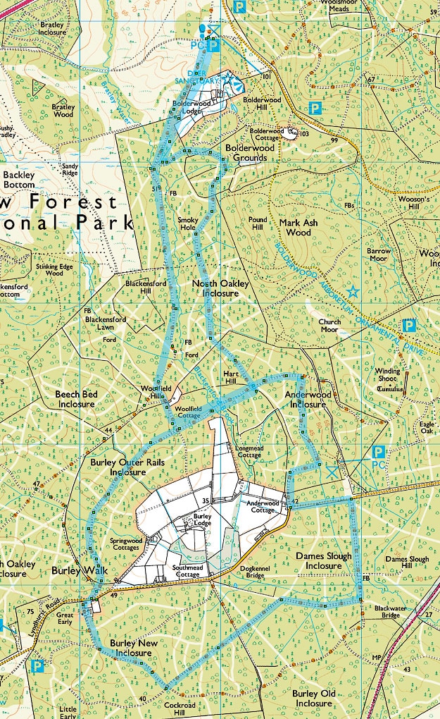
Route 8 Deer Sanctuary 6.2 miles or 6.7 miles
This can be extended to 6.7 miles if you take the Lyndhurst Road from the end of Burley Walk to Anderwood Cottage and then the cycle track through Anderwood Inclosure. It is a fairly quiet road with a decent verge.
This can be extended to 6.7 miles if you take the Lyndhurst Road from the end of Burley Walk to Anderwood Cottage and then the cycle track through Anderwood Inclosure. It is a fairly quiet road with a decent verge.
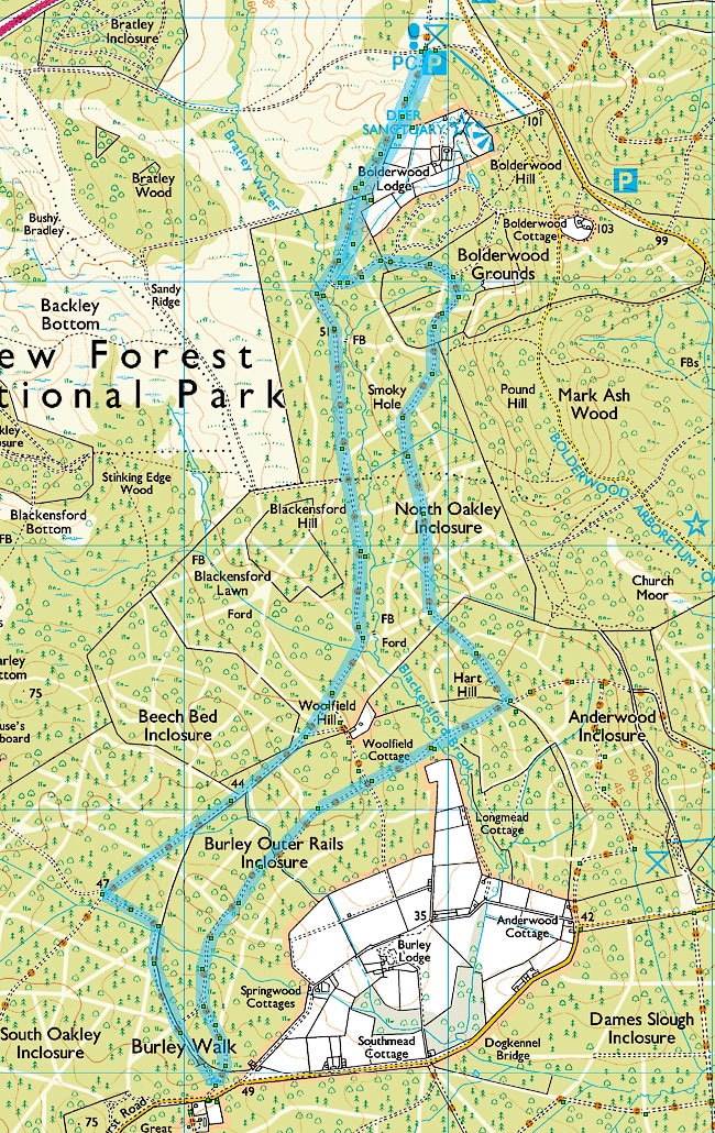
Route 9 Deer Sanctuary 8.8 miles
If you take the Lyndhurst Road from the end of Burley Walk to Anderwood Cottage this walk is reduced to 7.5 miles. It is a fairly quiet road with a decent verge. Do NOT try to cut across Dames Slough Inclosure. See the walkers blog entry for 21/12/2016.
If you take the Lyndhurst Road from the end of Burley Walk to Anderwood Cottage this walk is reduced to 7.5 miles. It is a fairly quiet road with a decent verge. Do NOT try to cut across Dames Slough Inclosure. See the walkers blog entry for 21/12/2016.
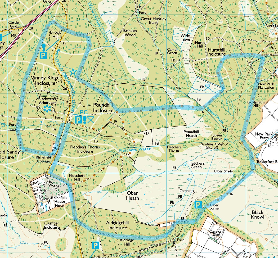
Route 10 Rhinefield 7.6 miles
Route 11 Wilvereley 7.7 miles
There are several options to change this route. Shorten it by staying on the road instead of entering Helmsley Inclosure, extend the route in Helmsley Inclosure, take the more southerly route through Brownhill and Wootton Coppice Inclosures coming onto the road at Holly Hatch Cottage (just off the bottom right corner of this map), take the more northerly route through Wilverley Inclosure. DO NOT even think about crossing Avon Water. See Walkers Blog 12/1/2016 and 1/2/2017.
There are several options to change this route. Shorten it by staying on the road instead of entering Helmsley Inclosure, extend the route in Helmsley Inclosure, take the more southerly route through Brownhill and Wootton Coppice Inclosures coming onto the road at Holly Hatch Cottage (just off the bottom right corner of this map), take the more northerly route through Wilverley Inclosure. DO NOT even think about crossing Avon Water. See Walkers Blog 12/1/2016 and 1/2/2017.
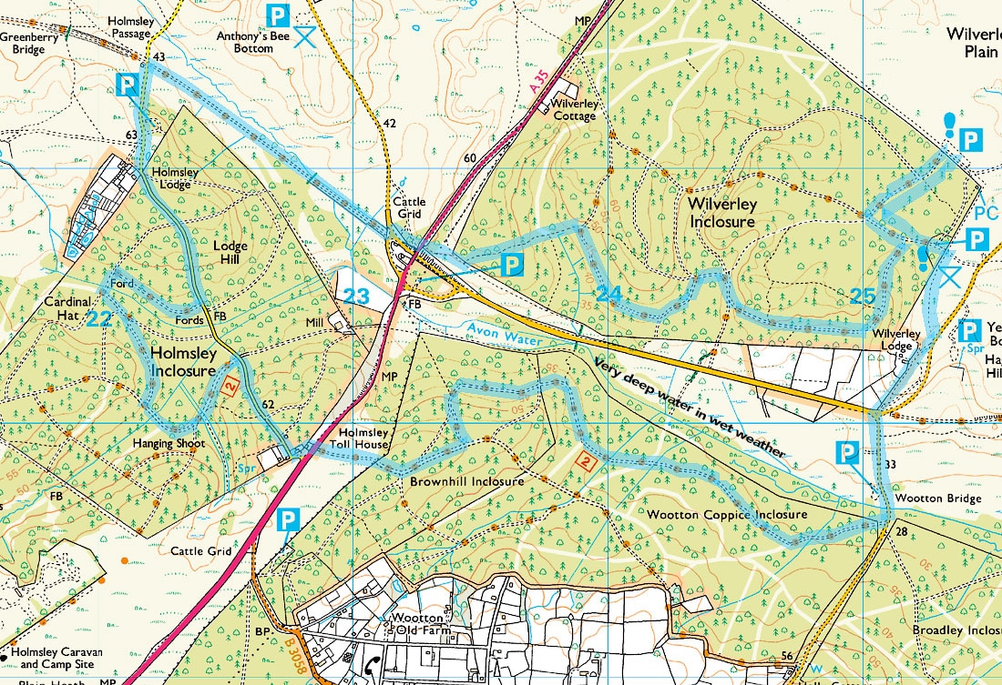
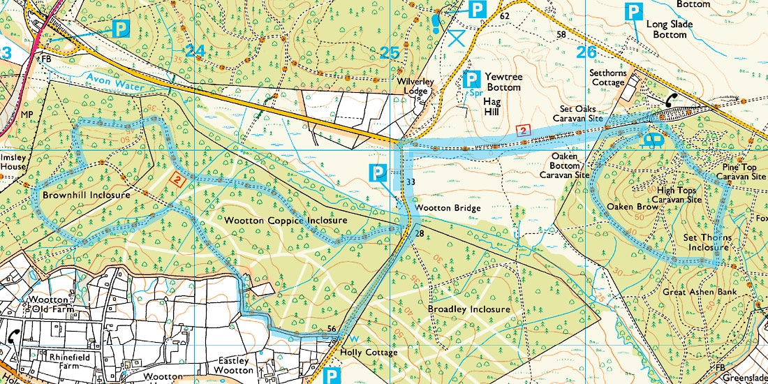
Route 12 Wootton Bridge 6.8 miles or 7.7 miles or 8.5 miles
If you are really worried about the weather you could try this "figure of 8" walk. Park at Wootton Bridge, do part of the walk returning to Wootton Bridge and deciding "weather" to go on! Other options start at the northernmost car park at Wilverley Plain this makes the walk 8.5 miles or start at the middle Wilverley car park that makes it 7.7 miles
If you are really worried about the weather you could try this "figure of 8" walk. Park at Wootton Bridge, do part of the walk returning to Wootton Bridge and deciding "weather" to go on! Other options start at the northernmost car park at Wilverley Plain this makes the walk 8.5 miles or start at the middle Wilverley car park that makes it 7.7 miles